Genealogy Research with Patent Deeds and Land Records
Using the BLM Federal Land Records Site and Farmapper to Research Patent Deeds
Originally published on medium 8/16/2017 but updated for improvements made to the Farmapper protocol.
History binds us to the land and becomes part of who we are and where we come from. Here we do some research on land patents and land records and then use Farmapper to create a project that mixes the historical record with “what it looks like today”.
The BLM (Bureau Land Management) provides a free database to search for Federal Land Patents of GLO records. This resource offers inquiring minds the ability to source information on the initial transfer of land titles from the Federal government to individuals. Using the land deed and Farmapper, it is easy to match ancestors with a specific location (Legal Land Description) and time (Issue Date). They have many Land Patents on their site, including Cash Entry, Homestead and Military Warrant patents at BLM GLO records.
There are many fun historical land records, plats and maps that demonstrate the original survey. These records make an easy comparison to what the land looks like in modern times using Farmapper versus the time when the land was patented. The maps, documents, etc. can be saved to the polygon shape. The ancestry project can then easily be shared with family and friends.
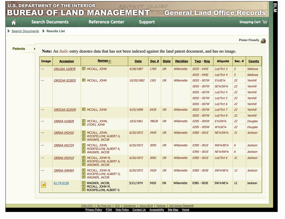
First, we go to the BLM site and click on the Land Patents database where we can search by state and name to see what we can dig up. I am searching in Oregon for John McCall and the following list of Land Records is indexed. I see the Accession 61–74–0130 in Jackson County has an image link.
The document has the following patent image that states that the land was transferred according to the April 24th act of Congress, with the snappy name “An Act making further provision for the sale of the Public Lands.” The deed transferred the Southwest Quarter of the Northeast Quarter of Township 38S, Range 3E in Section 12 to Jacob Wagner, John M. McCall and Albert G. Rockfellow. This is dated June 20, 1872, but wasn’t signed until May 21, 1974 for some reason.
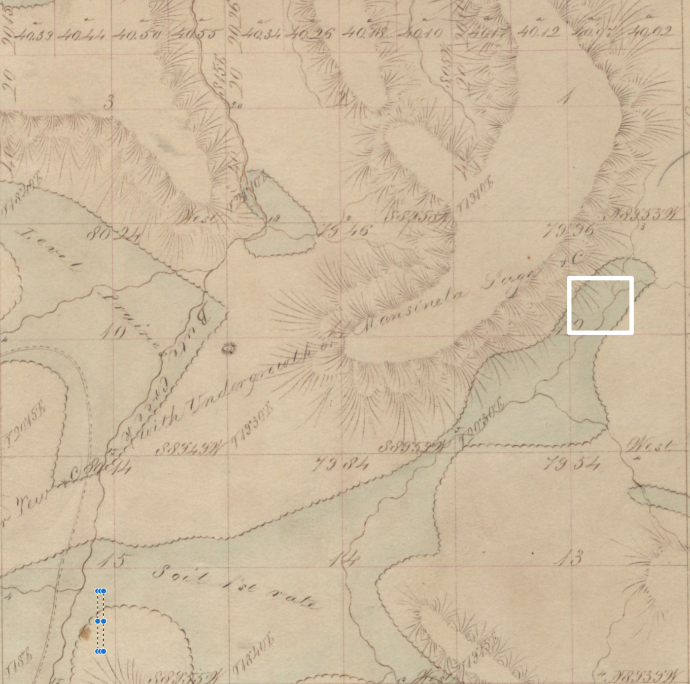
OK, so far so good. We have the original patent deed, but what other items are available for free on the website. If you click on the “Related Documents” tab, there are a multitude of other surveys. We are interested in the Original Survey that shows in the following screenshot which was meticulously surveyed and drawn around 12/23/1859. We will download the survey image and upload it to the project in Farmapper after we locate the legal description from the patent deed above.
Next, we go to Farmapper.com and login using a Google, Facebook or Twitter account so we can save our project which is named McCall Patent Deed Ancestry. We go to Green Inputs Button and select to add the legal description from the deed. We select Oregon, then Willamette Meridian, Township 38 South, Range 3 East, then Section 12. Then we check the box for the southwest quarter of the northeast quarter. To successfully plot the legal description aliquot, read backwards starting in the NE1/4 and then select the SW1/4 of it. For more on locating by legal description, check out Finding the Lost Farm, Learn How to Map a Rudimentary Legal Description. The screenshot of the correct legal look as follows and we click save.
After saving the legal description to make it stick, center the screen to the location of the deed by clicking on the tract listed on the left pane. Upon centering the map it should look as follows.
Looks like Dead Indian Memorial Rd., goes through the center of it now. Sounds like another research project where and how the road got its name. Now we compare the original survey to see how much it has changed from when the original chain crew surveyed it.
Section 12 looks like it has the notation of “Soil 1st Rate”, which is probably why they patented it to begin with. We will add the original survey (which is large at 12MB if you are on a phone) and the Patent Deed to the project document list by clicking on Documents in the left pane and then “Add new document.” So now we have both the original patent deed and the survey added to our project.
Now what else can we add to the project? What is fortunate is there is a book written about Southern Oregon in The History of Southern Oregon, Comprising Jackson, Josephine, Douglas, Curry and Coos Countries, Comp. from the Most Authentic Sources … — Albert G. Walling. J.M. McCall was in the military and formed the Ashland Woolen Mills as a joint-stock company consisting of thirty members, with J. M. McCall as president; C. K. Klum, secretary; and John Daley, superintendent. The mill was completed and equipped with the necessary operating and finishing machinery, at a cost of $32,000. We could upload the military records, photographs, newsclippings etc. to complete the project.
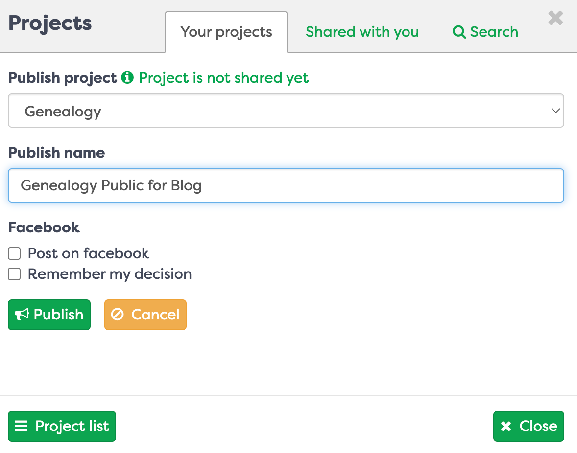
Last, I want to publish this link to its own public URL. I go to Projects and I select the “Publish” option and give it a Public name and then publish the link. Now the project has a URL link you can share with anyone.
Remember to log in with Farmapper account button. This allows the project to be saved under your account, using Google, Twitter or Facebook or email for authentication purposes. Basically, your own private farm map in the cloud. Then you can use advanced features, customize the color and shape of legal description polygons, upload deeds water rights, etc. and share with anyone. See a live link URL for this project here. You will also see the KML file, cropscape, documents including the survey and original patent images in the documents. Maybe if we get enough requests we will mint the Genealogy as an NFT?


